Day 6: Scale
Scale allows us to calculate the real distance between two points in a map.
We are going to calculate distance between Seville and Zaragoza using two different techniques:
the first one a graphic scale the second one a numeric scale.
Graphic Scale:
Day 6: Scale
Scale allows us to calculate the real distance between two points in a map.
We are going to calculate distance between Seville and Zaragoza using two different techniques:
the first one a graphic scale the second one a numeric scale.
Graphic Scale:
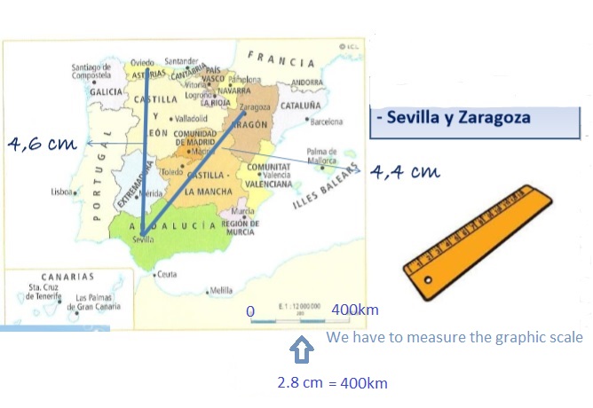
Calculate: 4,4x400 = 628km
2,8
Numeric Scale:


The numeric scale of this map is E.1:11900000 = 1 cm in the map is 11900000 cm in the real world.
11900000/100000 = 119 km
1 cm in the map is 119 km in the real world
We can We can calculate the distance between two points with this number:
- We have to measure the distance in our map between Zaragoza and Seville => 5.27 cm.
- 5.27 cm x 119 km = 628 km between Seville and Zaragoza.
No hay comentarios:
Publicar un comentario